Cell Phone Coverage in SE Alaska

There is a surprisingly large area of cell phone coverage across SE Alaska that is available to the non-satellite user. One would expect to have decent coverage near the large communities such as Sitka, Juneau or Ketchikan, but many smaller communities also have towers such as Thorne Bay, Kake, Angoon or Hoonah. These towers reach across islands and large channels providing coverage in unexpected locations. To be sure, most of the time when you are away from any civilization the dreaded “No Signal” will be displayed, but one can expect brief coverage once or twice a day when cruising the main routes. The strength of the signal drops fast and for a lot of the locations one will need to be within ten miles. I have included a list of cell tower locations at the bottom of this blog.

AT&T coverage is probably the best and has extended 3G voice and mobile broadband.  Verizon has extended 3G voice and mobile broadband for some locations and partners with ACS Communications.  Some of the other wireless services such as T-Mobile do as well. Be prepared for roaming charges.

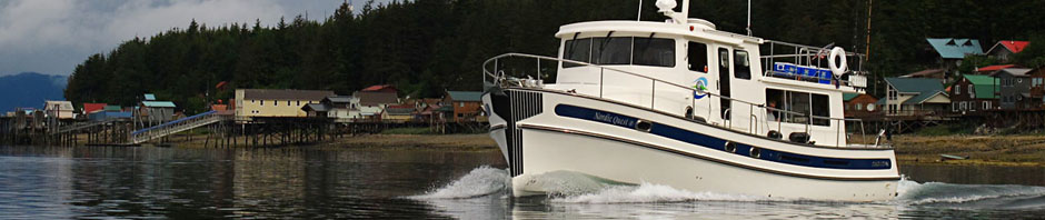
It is rather funny to look about the boat just after someone discovers that there is coverage…everyone is on their phones, texting or checking e-mail. Connectivity has changed our lives and friends and loved ones expect immediate news of our vacation. Photos and fish tales need not await returning home, news or a camera photo of the big catch can be added to a text message or posted to Facebook right away.

Cell Tower  Locations in SE Alaska

Ketchikan Kake Haines
Craig Angoon Skagway
Thorne Bay Sitka Juneau
Wrangell Hoonah
Petersburg Gustavus
Posted in Alaska, Travel Hints | Tagged , , , | Leave a comment

Furloughed? Why Not Go Fishing?

Sounds crazy? Well a few days off is a sure way to get rid of that stress that Congress is giving everyone. And spending them in SE Alaska is even better. Cell phone service is quite scattered (see my blogsite next week for more on that topic) and nothing is more relaxing than anchored in a small bay, sitting back and talking fishing with your close friends.

My real job depends on government contracts quite a lot. Fortunately most of the current work is funded and unlikely to be reduced. The company has faced reductions in federal funding before and got through them. So it’s time to make plans for leaving everything behind and head north to Alaska. I want to visit some of my favorite halibut and salmon hotspots (Yes; I just might put a few in my blogs so come back regularly) and to watch the little brown bear cubs paraded out by their mamas to see and learn how to survive in the wonderful Alaskan environment. But first I have to get there. Come the first of May, the Nordic Quest goes back into the water, gets checked out, re-provisioned and heads north through British Columbia. When we hit the U.S. boundary south of Ketchikan, the lines go down and we’ll fish our way to Juneau. Once there, she is detailed and ready for charter. Bow to stern, inside and out, Nordic Tug Charters really knows how to take care of the boats the company has available. Anyone who has chartered the Nordic Quest in recent years can tell you it’s like stepping onto a new boat. This year several additional safety features have been added–AIS, a Lifesling and a 6-man inflatable liferaft, the only 42-footer with these features. So click on the Charter page or the link to Nordic Tug Charters. There are a few really good slots still available for the 2013 season.


Posted in Alaska, Fishing, Travel Hints | Tagged , , | Leave a comment

Photo of the Week – Helm

Driving

The driver’s view from the helm of the Nordic Quest

Posted in Cruising, Photo of the Week | Tagged , | Leave a comment

2013 Alaska Pacific Halibut Catch

The International Pacific Halibut Commission’s 2013 catch reports were issued at their January 21-25, 2013 meeting in Victoria, British Columbia. As I have historically fished in Southeast Alaska (Area 2C), I took a look at the numbers for this regulatory area.

The 2012 Pacific Halibut catch in Area 2C by the Unguided (Private) and Charter (Guided) Sport Fishery totaled 1,406 million pounds (preliminary estimate) or a 37 percent increase over the 2011 catch. However it was only 58% of the preceding ten-year average. The charter catch for 2012 was up significantly as a percentage of the Guideline Harvest Level (GHL) from 2011, 56% in 2012 vs. 37% in 2011. The Private catch in 2012 continued to be greater than the Charter catch at 54.1% of the total catch in 2012 and 66.6% in 2011. The decease could be due to the change in the Charter regulations to allow a U45/O68 (under 45 inches or over 68 inches) reverse slot size in 2012 but there was still the one fish limit for charters while the limit remained at two any size for private sport fisherman.  For the novice halibut fisherman this means if you fish with a guide, you are allowed to keep one halibut per day that is under 42.9 pounds or over 163.3 pounds. Personally I prefer a 40 pound halibut any day over a 165 pounder.

Looking at the total Pacific Halibut catch, the Commission recommended a further reduction in 2013 of 7.5% from 33.54 million pounds in 2012 to 31.028 million pounds in 2013. A slight increase has been proposed for Area 2C raising it to 2.97 million pounds from 2.624 million pounds. These numbers include the commercial catch and the sport catch.

My personal observation as a private sport angler and having fished halibut in SE Alaska nine out of the last ten years was that 2012 was better. In recent years,  myself and my guests had consistently caught our limit but the fish averaged under 30 inches with an occasional big one. Last year, in less than 40 rod hours, we landed eight halibut averaging 45 pounds.

We should see the 2013 Alaska fishing regulations issued sometime in late March. Rumors are that they will be pretty much status quo with 2012. I’ll post a summary on my blog as soon as they are released. Hopefully I won’t have to eat my good luck hat.

Posted in Alaska, Fishing, News | Tagged , , | Leave a comment

Photo of the Week – Sunset over St. Johns Harbor

Sunset over St. Johns Harbor

A beautiful sunset over St. Johns Harbor

Posted in Photo of the Week, Places | Tagged , , | Leave a comment

Alston Cove

Laredo Inlet is a beautiful place to explore. It is a bit off the usual north-south cruising route, accessed by the scenic Meyers Passage. Wildlife viewing, fishing, and great scenery, the area offers enough for a few days of exploration.

If one is to spend a few days, then a couple good anchorages are needed, and there are a few to choose from… Bay of Plenty, Fifer Cove and Alston Cove are all good choices.

The chart shows a three fathom bar at the entrance. It may be a bit shallower, both in and out our depth guage showed just over twenty feet of water under the Nordic Quest’s keel on a ten foot high tide. Perhaps we just missed the deeper channel? Otherwise entry is easy.

Anchor in forty to fifty feet of water at the rear of the cove off the alluvial fan of Blee creek.


View Larger Map

Posted in Anchorages, BC Places | Tagged , , , | Leave a comment

Photo of the Week – Aurorae

Aurorae over St. John's Harbor

Aurorae over St. John’s Harbor on September 4th, 2012 from a massive CME ejected from the Sun on August 31

Posted in Astronomy & Sky Events, Photo of the Week | Tagged , | Leave a comment

Bay of Plenty

Another good anchorage that can be used while exploring Laredo Inlet in the beautiful Princess Royal Island. This bay is on the western side of the inlet towards the northern end. The other anchorages we have explored and can recommend, Alston Cove and Fifer Cove, are on the eastern shore.

The entry was quite nice, we entered on the south side, then wove in between the islands to the north side, following the deepest water on the chart. We suspect the entry along the northern shore is also usable, but have not tried this route. Inside we found a scenic bay surrounded in solitude. In this untouched land it was easy to imagine we were the first to ever explore the area.

Anchoring is simple, we dropped the hook in 40ft of water right in the middle of the bay. There was a very gentle slope once well behind the islands. With no current and excellent shelter there was little worry of any shifting in the night.

We found rather little when exploring up the river here, little wildlife to be seen, perhaps we were too late in the season for the salmon run. We did not drop crab pots, but crabbing is reported to be good here.


View Larger Map

Posted in Anchorages, BC Places | Tagged , , , , , | Leave a comment

Photo of the Week – Fallen Totem

Fallen Totem

The remains of a totem pole at Mamalilaculla, Village Island, British Columbia

Posted in BC History, BC Places, Photo of the Week | Tagged , | Leave a comment

Photo of the Week – Mamalilaculla

The Ruins of Mamalilaculla

The ruins of a village at Mamalilaculla, on Village Island, British Columbia

Posted in BC History, BC Places, Photo of the Week | Tagged , , | Leave a comment